I didn't see much of Edinburgh in the end, mainly due to the weather. Instead of sheltering in a pub in town I ventured out to Stirling, further up the Forth river, to check out the castle there. Unlike the one in Edinburgh, it wasn't closed for safety reasons. Like Edinburgh, Stirling castle sits on a rocky outcrop overlooking the surrounding area. Numerous Scottish monarchs were crowned here - Stirling was the royal capital for a long time. Most of the current structure dates to the 1500s and the Stuart kings. It's more like a collection of large houses than a castle as such. Inside, particularly the Great Hall and the chapel, was quite disappointing as the rooms are empty. No furniture, wall decorations, religious icons, weapons displays, etc.
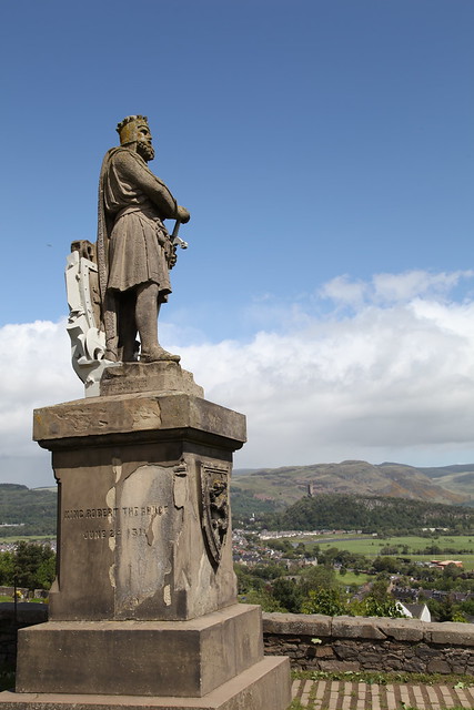
Robert the Bruce statue in the castle grounds. The enormous Wallace monument is nearby but I didn't visit it.
I spent one very pleasant afternoon with a flickr friend, Devoran, who lives across the Forth from Edinburgh. We went into the nearby town of Aberdour and checked out the beach and the castle.

Aberdour is one of the oldest castles still standing in Scotland apparently.
It wasn't really beach weather but we had fun anyway :)
I also took a cruise along the Firth of Forth to Inchcolm island where there's an old abbey.
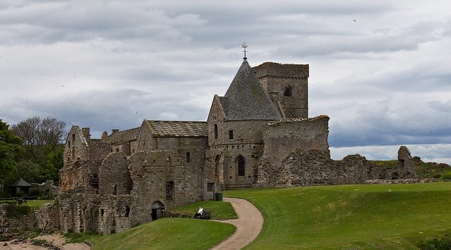
The current abbey dates back to the 1400s but there's been an abbey there since the 1120s. It was built by Alexander I who took shelter on the island during a storm. The only person there was an old hermit and Alexander promised to build him an abbey, which he did. There's no record of whether the hermit appreciated this or not.
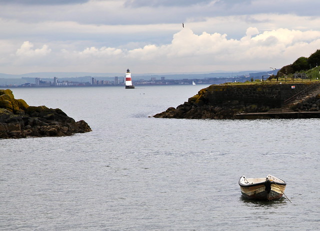
The Firth is dotted with small islands which provide homes for the many sea birds in these parts. Inch is the Scottish word for island. There are apparently Puffins that nest there but I didn't see any. There's also a small lighthouse, seemingly standing in the water, which provides warning about the nasty reef below it.
The cruise takes you under the Forth Rail Bridge, one of two bridges spanning the Firth of Forth, about 20 miles from Edinburgh itself.
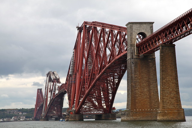
Both bridges were marvels of engineering in their time. The rail bridge is more interesting to look at than the road bridge. I think anyway.
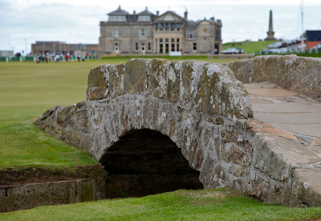
From Edinburgh I headed north to Inverness, via St Andrews. I don't play golf but my father does. Even so, the courses at St Andrews (there are seven of them at the Royal and Ancient) are lovely to look at. Apparently you have to book months in advance to get a game there.
Inverness is in the Highlands, at the top end of Loch Ness. The town itself is quite large but I didn't spend much time there as I did a lot of day trips to various places in the area.
John o' Groats was a must, seeing as I was at Land's End a while ago.
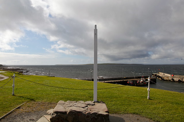
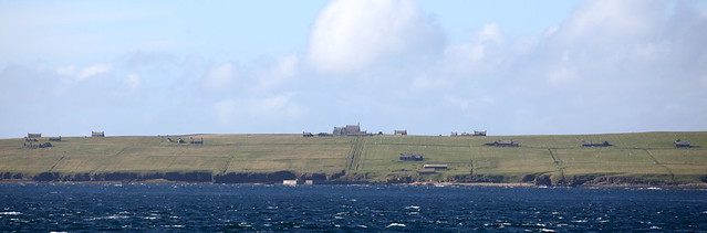
This end of the UK is quieter than the other end. There's no fairground/theme park for the youngsters and the old hotel is closed. The signpost (which is operated by a private photography firm) was also closed because I got there after 5pm. Across the Pentland Firth is the island of Stroma, now abandoned, and the Orkneys beyond that. You'd have to be tough to live in this area: it's cold and windy and quite isolated.
Dunnet Head, just further along the road, is actually the most northerly point of the UK mainland.
The coastal road from Inverness to John o'Groats is a very pretty drive. Coastal villages, farms and spectacular views all the way.
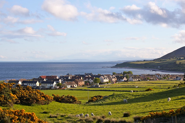
Many of the villages were set up during The Clearances of the 18th and 19th centuries. The farmers (crofters) who'd lived in the Highlands for centuries were forcibly removed (cleared) from their farms by the landholders to make way for sheep. Many Scots left the country altogether, emigrating to places like Liverpool and the US. Consequently the Highland population decreased dramatically and has never recovered. The Clearances also helped destroy the clan system of social organisation that had ruled Scottish life for so long beforehand.
The Duke of Sutherland was probably the most ruthless of the Clearance landlords. Ironically, on a hill behind one of the towns in the Sutherland area, there's a 100 foot statue of the Duke - put there by the locals.
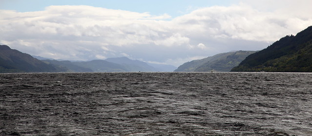
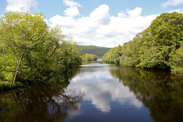
A visit to Inverness is not complete without a cruise on Loch Ness. The one I took lasts for 3 hours and goes down to Urquhart Castle and back. The Loch actually now forms part of the Caledonian Canal which dissects the Highlands from north-east to south-west.
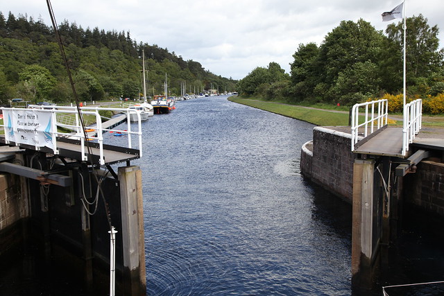
It follows the Great Glen, a natural glacial fissure which crosses the country along the same line. The Canal is 62 miles long but two-thirds of it are natural lochs (Dochfour, Oich, Ness and Lochy).
Loch Ness is the largest, by volume, body of fresh water in the UK. (Loch Lomond is the biggest by surface area.) Ness' waters run to over 200 metres deep and are dark and peaty, so there are plenty of places for Nessie to hide. She hasn't shown herself to me yet.
Another day trip involved a drive through part of the Cairngorms National Park to Balmoral.
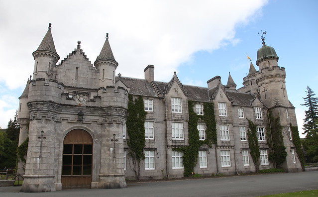
Balmoral Castle is the summer holiday residence of the Royal Family and is only open to the public from April to June. It's privately owned by the Queen, not Crown land. I think Queen Victoria bought it originally. The grounds are vast and range from woodland to manicured rose gardens. The roses are managed so that they're in bloom when the Queen and co are there and not a moment before. I noticed lots of security cameras around the grounds. The ballroom is the only room open to the public and has a display of various royal paraphenalia - dinner services, some of the Queen's outfits, paintings and such like. She apparently likes Landseer quite a lot.
I also drove along the Lecht Road which goes across the top of the Cairngorms. It's a road that's frequently closed due to snow and I could see great patches of snow on nearby mountaintops. The views are spectacular though.
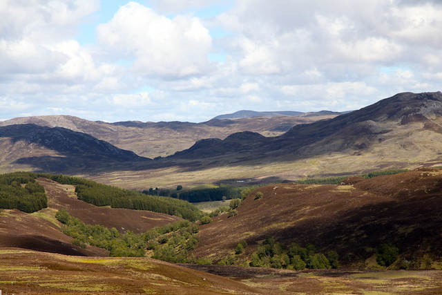
The Cairngorms take their name from Cairn Gorm, one of the peaks there, and translates as the Blue Hills - though they're known colloquially as the Red Hills, so go figure. The mountains here are quite low, rising to just over 800 metres and quite rounded. There are occasional patches of pine forest, particluarly in the Dee River valleys but, for the most part, the hills are relatively bare; just heather and gorse. There are no settlements or roads either: just the main highways which skirt the edges of the area. You'd have to be keen to walk them. The only inhabitants appear to be sheep.
The hillsides are covered in a patchwork of old and new heather, created by regular controlled burnings. This is to accommodate the grouse apparently, and, no doubt, the weirdos who like to shoot them. Still, it makes for an interesting landscape.
I also went in search of Boleskine House, once owned by Jimmy Page and, way back by Alistair Crowley.
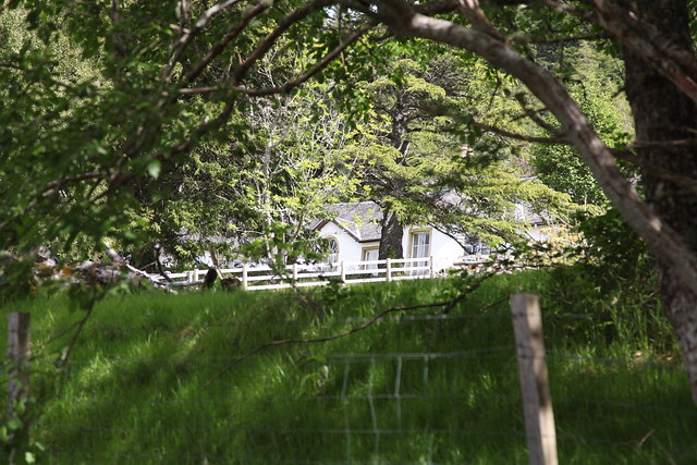
It's on the road that follows the eastern side of Loch Ness, just outside the town of Foyers. It's surrounded by trees so I couldn't get a good view unfortunately. Between the house and the Loch is a graveyard. Spooky!
The next stage of the Scottish adventure is Fort William, the second largest town in the Highlands (after Inverness). From there I can take the Jacobite steam train (aka the Hogwarts Express) to Mallaig and back, visit the Isle of Skye and view Ben Nevis.
PS.
It's not always cold, wet and windy in Scotland. There are occasional periods of sunshine - although it is always windy! I'm beginning to think that the only difference between summer and winter in Scotland is that in summer the trees have leaves.
Later...
2 comments:
I reckon I could get past that Robert the Bruce, if I was quick.
You haven't been eaten by a monster ... have you?
Post a Comment